
La Bonita Road
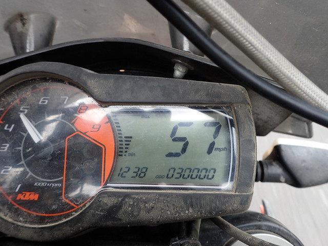
The morning after crossing into Ecuador I headed east from the border town of Tulcan towards the last cities before the Amazon starts. I heard of a road in the north called La Bonita road. I read about it on some “birder” blog about some guy who had taken it in a 4x4 to look at birds in 2010. I didn’t know much else about it except that I heard from other motorcycle travelers that it wasn’t passable, it wasn’t on google maps and wasn’t properly on my GPS. Sometimes roads will appear on the GPS but they aren’t real roads, sometimes you can tell because the road will be too straight and yet cross many topo lines…maybe they are/were planned roads. I asked around about the road at the border but no one knew anything about it. The problem with asking directions or about roads like these is that people don’t take them. People here take busses and busses take the main route. It’s not until you actually get on the road that you can learn more about it. On an unrelated note my bike turned over 30k miles!
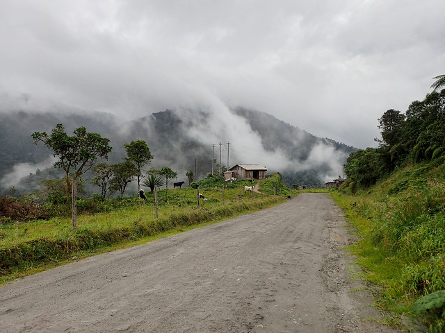
After some searching and navigation by geographical features I was able to find the road. The first bit of the road was well paved, fun but a little foggy. I came across cones blocking the road and a military check point. As I approached, one of the soldiers moved a cone, I thought that was his way of telling me to pass so I flew by it. After a mile or so I realized that I was heading straight north…I was already pretty close to the Colombian border and should have been heading east so I turned around to ask at the check point. I thought maybe that this wasn’t the right road after all. Turns out that checkpoint was an aduana and a border crossing and I had “left ecuador”. After some paperwork and apologies they told me that a little dirt road just before the checkpoint was the road I wanted.
The dirt road was awesome. Narrow, a little wet, mostly smooth and twisty with a lot of elevation change. I had a lot of fun sliding it around and there was just the right amount of tackiness to recover grip when things got a little too sideways. As I got further in the road widened and there were some farm houses built right on the cliff sides with some stunning views.
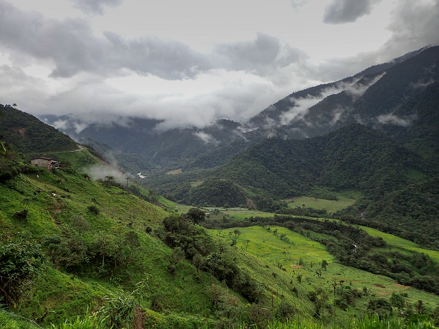
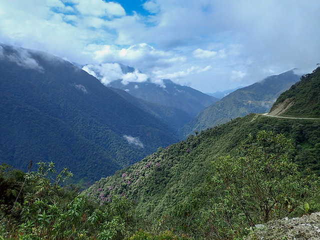
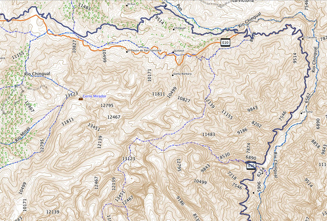
After a solid hundred miles of dirt the road turned back to pavement. Where it was still intact it was smooth however there was a ton of obstructions. There were rocks that had fallen from above. There were entire chunks of road missing. There were washouts and landslides. There were sections of pavement lifted up or sunk into the ground. All of this around twisties right out of a motorcyclists dream. I had a lot of fun pushing it through those roads with lots of acceleration and keeping my lines flexible. A good 60 or so miles of this road which led down into the canyon past huge waterfalls and cool little bridges. Unfortunately, I was having too much fun and didn’t stop for a single picture. Here's a snapshot from the GPS track.
Lago Agrio to Coca and Back
A meandering ride as the mountains turned into jungle. Roads following oil pipelines passing through towns that looked like they were out of the wild west. When I got to Lago Agrio I started asking around for tours but no one knew what I was talking about. Some motorcyclist friends said they booked their tour from Coca, which was 90km south so I decided to push on there to ask. The ride there was boring and a little rainy. Coca is probably the worst town I’ve ever been to. Ugly and built around the oil industry with no redeeming qualities. I got stuck behind this parade.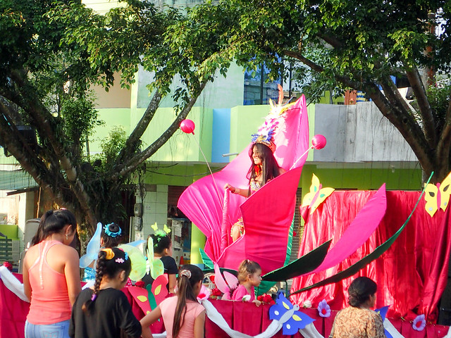
I asked around Coca and found one tour company. However all the tours were very expensive. Over $400 was the cheapest one and that was camping. I’m fine with camping but not for $400! The guy said the Cuyabeno trips were cheaper and more adventurous and that these lodges had solar panels, hot water, electricity and so on. Not really what I had in mind for a trip into the Jungle. The problem with the Cuyabeno trips is you book them from Lago Agrio. They gave me directions to a guy in Lago Agrio so I headed back the way I came…back to Lago.
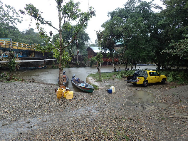
In Lago I was able to book a tour with a lodge and the guy said I could ride out to the boat and leave my bike at a house by the bridge. That sounded better than leaving the bike in Lago and taking a bus out there.
Cuyabeno
I left in the morning and the ride was great right up until it started to down pour. I had to reorganize my pack and store the bike all in the pouring rain. The bridge was very easy to find and the boat was there waiting. Unfortunately, the rain didn’t let up much for the entire 2hr motorized canoe ride down river to the lodge.
The lodge was great. Surprisingly comfortable. The next 4 days included hiking in the jungle (sometimes barefoot), paddling 4 hrs down river to a native community, eating monkey, swimming in the lagoon, spotting grey and pink dolphins, feeding cayman, catching piranhas, playing with tarantulas, night boat rides, night hikes, spiders, birds, monkeys, giant fish and so on. I could write about it for hours but this is a motorcycle blog...check out the photo gallery below!

0 comments:
Post a Comment