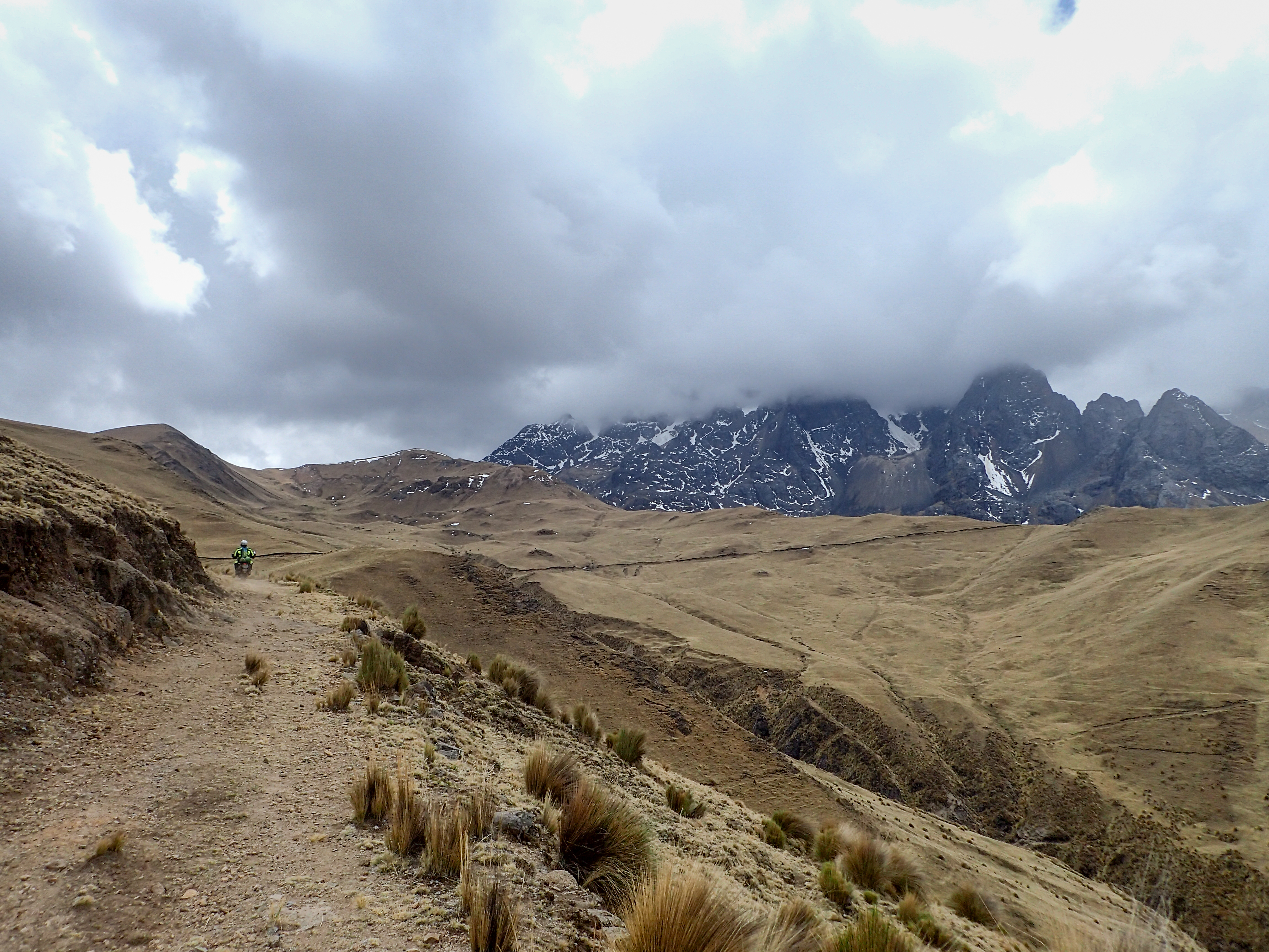
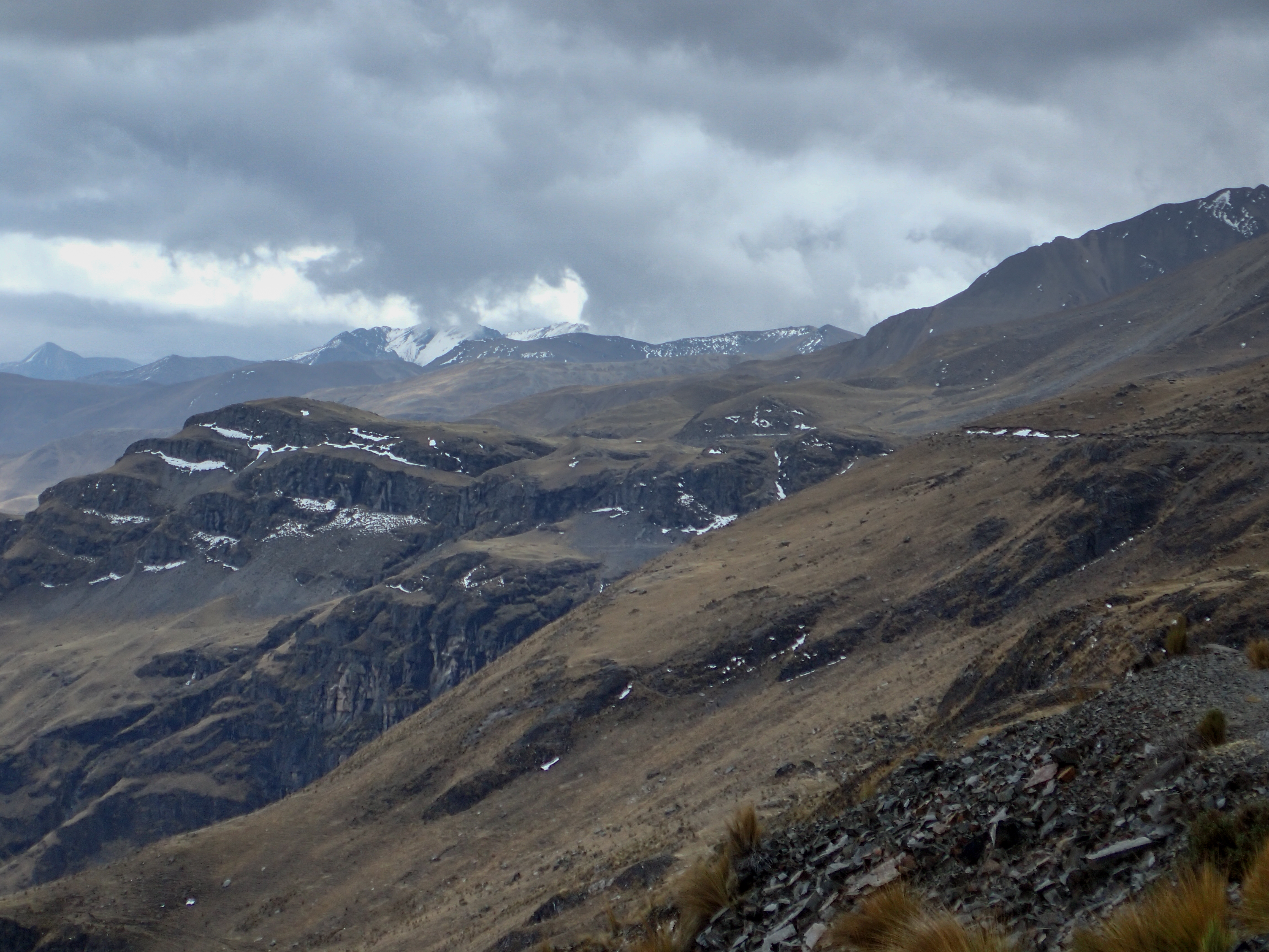
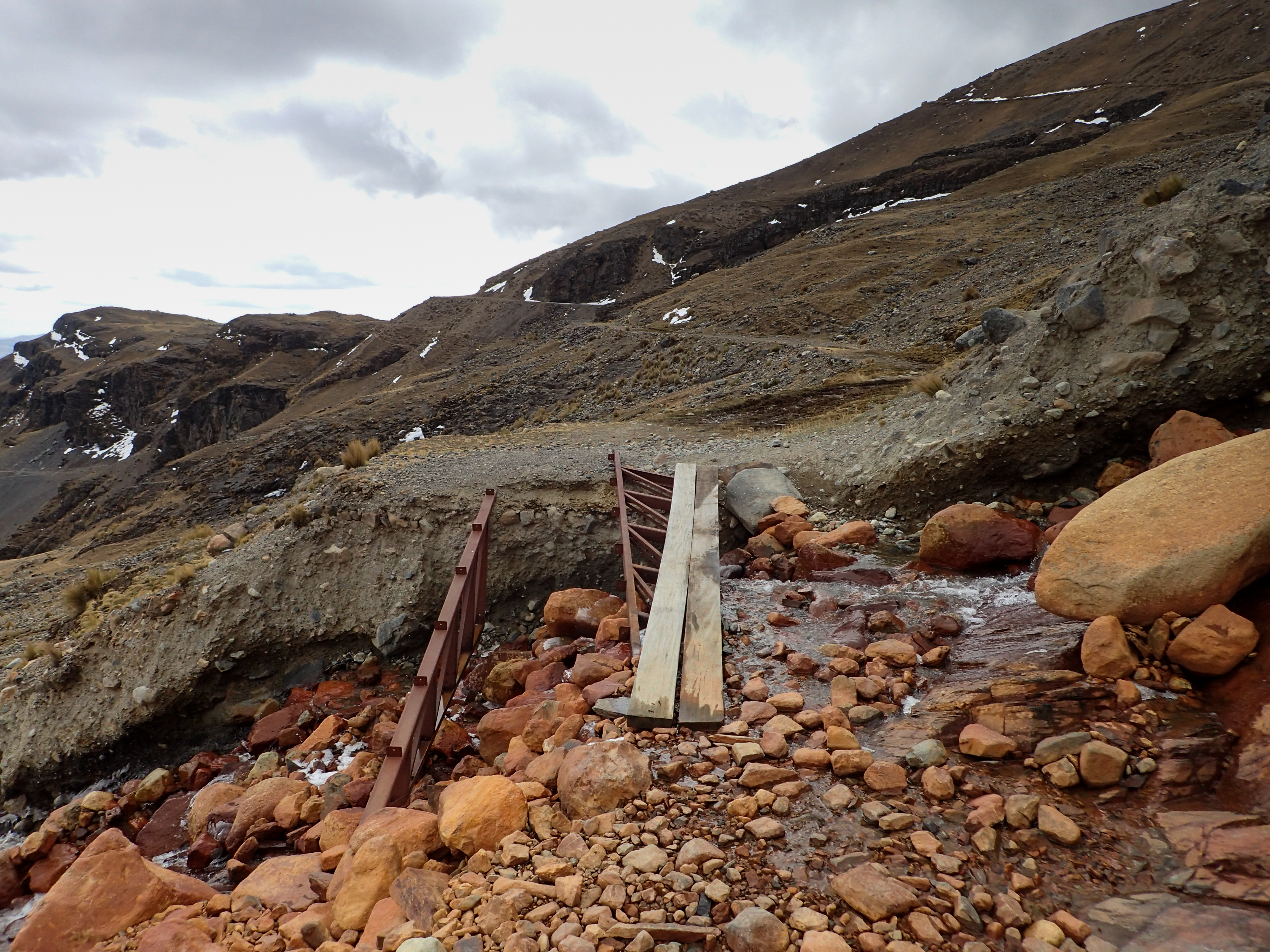
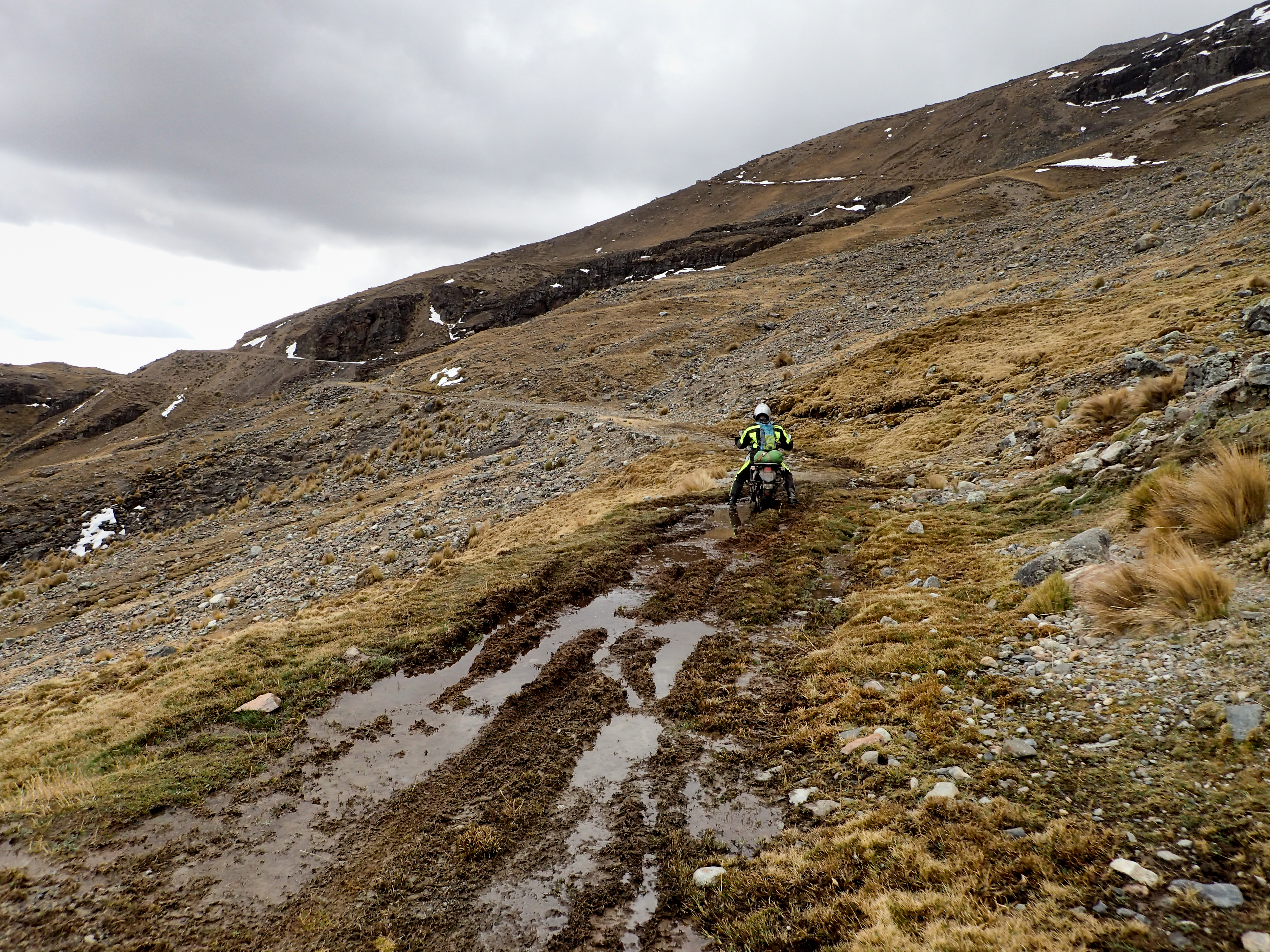
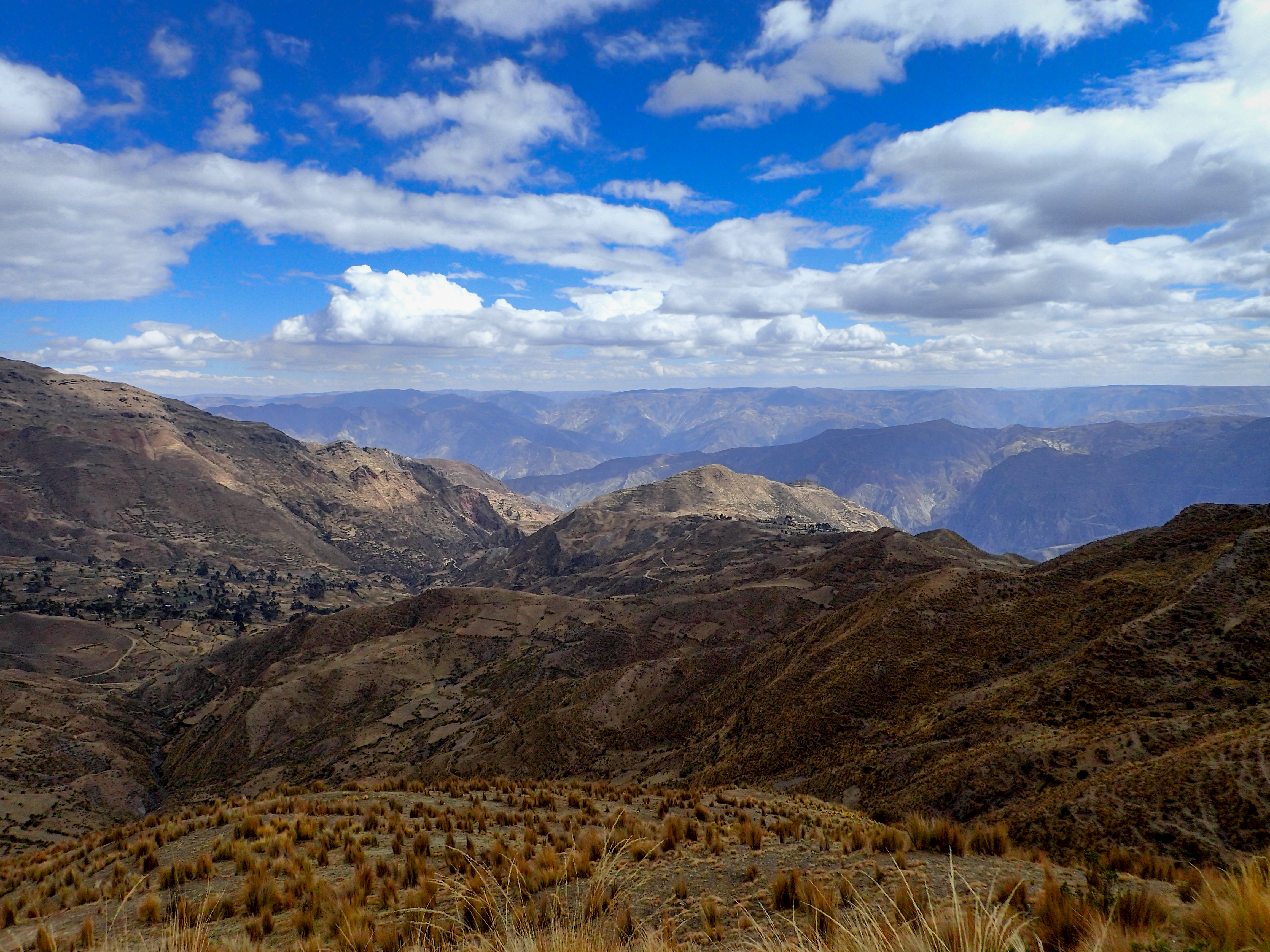
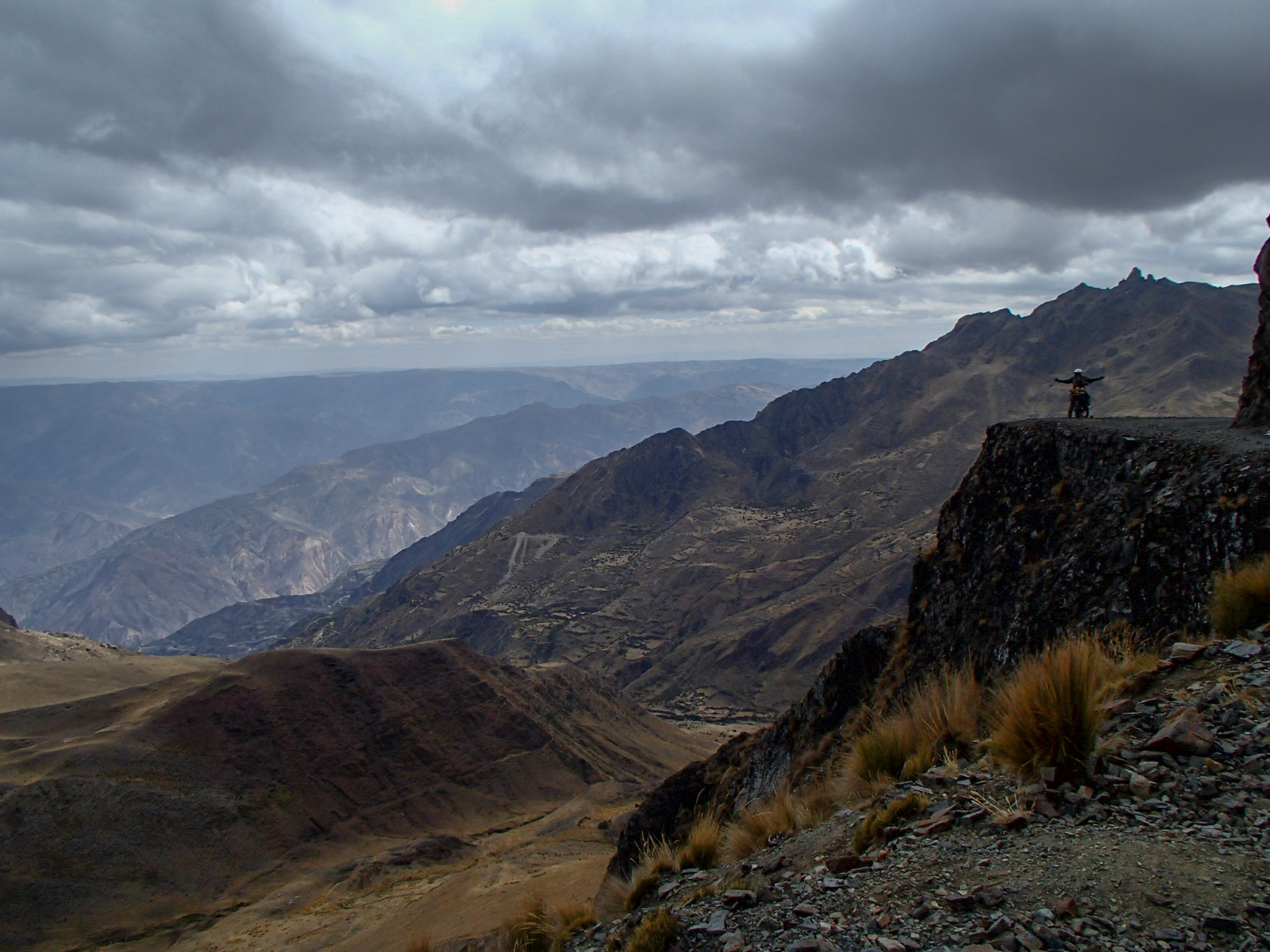
Day ride out of La Paz on minimal gear setup. First stop is Valle de la Luna which is a small rock garden then off the pavement onto some back roads heading towards Illimani…a mountain with a glacier. We saw on google earth a track that switch backs up within a km of the ice and thought just maybe we could get the bikes up there. A beautiful and long dirt road out to the switchbacks but it was not to be…shortly up the road it was blocked by a very tall stack of rocks probably signifying that path was no longer passable. Trying to get through a town there was a gnarly, windy, long, hill climb with ruts rocks and steep as hell. Turns out there was another way around and the KLR didn’t have the power to get up it. Later, Tucker noticed the KLR was way down on power and we pulled the filter and realized it was filthy…he had a new one but no oil so we used some engine oil to tide us over. After the switch backs we looked for an alternate route back to La Paz. Stopping and asking a guy in a very small village he told us of a turn off 6km back the way we came. The turn off was small and the road looked like a farm road and nothing more. There were no fresh tracks and the road was overgrown with grass…certainly no cars or trucks had been down the road in a while. But it continued to be passable so we pushed on. After quite a long way we reached a make shift fence of broken plastic pieces and ripped tarps. We moved the fence and then put it back but shortly after it realized why it was there. The road was out and just 2 small precariously placed boards crossed a narrow gap of bike loss and possible death. We were too far in to turn around however and so we fought the bikes through off to the side where we thought we’d have a better shot of not losing the bike if we went over. With both of safely by we pushed on. Not too far later we saw a jeep and a tent out in a field. I thought we should go talk to the guy and make sure we knew the way out of there. I jump into the field and as I’m warning Tucker that it could be wet I lose all traction on the grass and slide all the way down the hill with the front and the rear sliding. Luckily, with the clutch in and neutral on the brakes I was able to basically balance and skate the whole way down. There was one guy there who was from Bolivia and a guide. Apparently that’s base camp for climbing up the mountain. He told us how to get back to La Paz and we trekked back across the slippery field across little muddy streams…we both got a little stuck at one stream crossing because it was narrow and deep and very slick and muddy on the opposite bank. Continuing to meander through the mountain pass we hit snow and ice and a storm where it started to snow. It was very cold, in the 30’s, and visibility was tough. Within about 40km of La Paz the roads started getting wider and better but still dirt almost all the way to La Paz. The vistas and the mountain ranges were dynamic and stunning the whole day. It’s a long hard day so get an early start and keep moving. We weren’t able to stop for food…just snacks on short breaks.


0 comments:
Post a Comment